Showing posts with label cycling asia. Show all posts

Friday, May 31, 2013

Seoul to Busan Cycling Trip - Korea 2012 // 서울 - 부산 자전거 여행 - 대한민국 // Bicycle Touring Adventures in South Korea

Cycling in Korea - Where the adventure bicycling begins! 


Chris Ambridge contacted me to share his friends Seoul-Busan bike trip. It's a fun video that captures the excitement and power of exploring on bicycles. Great adventures start here!
Chris A, Chris B, Albert & Tom
Special Thanks to Marta Longas!
Seoul > Busan
559 km
30 hrs
4 Days
October 2012
서울 - 부산 자전거 여행 - 대한민국 2012


Bikes and backpacks in Korea. Stay at Jim-jil-bangs, Hotels, Minbaks or camping.  
(Riding from Gangneung to Busan in 2009)

Wednesday, January 9, 2013

Mongolia X Journal 2 // Mountain Mysteries, The Marmot, the Wolf, the Nomads

X Journal 2
Peaceful tracks, forgiving pastures and then the steep, hardened arid dirt tracks of the northwest. I seem to be making good progress today. I am above the mosquito deserts now, out of the inhaling swarms. I am almost a free bird now and the kilometers have stacked up in my favor. Going back now, the herders and I gathered by the coal stove that cold night, the smoke twisting up and around the tent, the downdraft of plateau winds taking us all inside. I warned them of "carcinogens" but all my words are incomprehensible now, they have been for weeks and weeks.

I might never be entirely successful at communicating without a common language, but I always make considerable efforts to communicate beyond borders, beyond languages, and connect with people of cultures new to me. I believe it's important to consider that all life on Earth has a connection, though there may not always be direct communication. For us humans, we communicate through language, voice tones and intonations, through movements and body languages, and it can be understood. Throughout my journey across Mongolia this summer, I have encountered many people, met their families and we gathered together in a single location - the Ger. The steel pot stoves are at the center, there are usually 2 supporting interior poles inside, linoleum mats for the entrance area then rugs, the women sit on the right and the men sit on the left (visiting too). There is an organization and order about the Ger, it's a sacred place and a living space at the same time, one room.

We gathered around the pot stove, the twigs and branches were all collected from the craggy mountain chasms and boulder areas above us. Now the dry timber wood was starting to "pop, crackle" as the steel pot stove opened and closed with gasps of oxygen surging into the glowing embers. Other Nomad herders were behind me smashing coal rocks into small shards and hand-sized chunks to fuel the fire's hearth. Some Herders were also summering on the 2500 meter plateaus while on their university vacations, their families tended to a herd of 50 goats and a few dozen sheep, they were prosperous holding a Ger store in the camp, they catered to all other Nomad families in this area. We all ran into the motorcycle Nomads here, the alcohol-driven madmen had appeared over the same horizons that I climbed for 12 grueling hours mixed with relief of local Nomad tents, children sawing wood the old fashioned way, or wrestling with each other. The summer is a pleasurable time in Mongolia, it also requires Nomads to keep to their flocks, working longer days, and preparing for the inevitable harsh winters.

I had been lost for a few hours after crossing the divide (2500 meters, 8200 feet). There were 1400 meters now between myself and the deserts below had taken me only to this ledge. Only a few horse single tracks were distinguishable, and I was moving 12km/h cycling or stepping down and walking 5km/h for the past 12 hours. "Soon..." I thought aloud to myself that the end should be in sight. I looked across the mountains, I could easily climb right off and para-glide out for 20 kilometers across the translucent blue sky to reach the valley floor. Checking the Garmin 705 GPS again, a small track is visible here, nothing visible to the north in my gaze, except the visibility of a twin jeep track across the deep valley running from East to Wes,t where I wanted to go. I started the techincal XC mountain descent without tracks or any hesitations, jumping stones, pushing the Fox Racing forks in their element and avoiding the marmot holes. My mind wandered as I wondered about wolves and where this trackless space was heading. The topography of this area was now important because I had no route to follow and needed to take even more care not to become injured while riding off-tracks, alone.

The huge curving mountain luring me below on a grade too steep to see clearly, although the desert floor was always in sight. The pitch increased 200 meters down and over the mesa, it was unrideable to reach the end. I turned my head around and saw the silhouette of a Nomad on a horse over the crest of the mountains. I checked the GPS again, and then my compass, there would be no turning back after another 500 meters out and I had 750cc of water left, so I would need to refill before dark.

Earlier, I amused seeing a white sheep-man hunting. I thought, "What in the world is sheep doing with a gun, haha" I kept pedaling down, catching the surface and cutting lines on the rough 9% grade. The sheep-man leveled his wooden rifle, I took out my camera and he was facing downhill towards me, perhaps a good shot for a marmot, this must be a sport hunter of some kind. When he fired his shot, he pegged the poor marmot standing on it's hinds 50 meters ahead of me, the gun was pointed right at me but the bullet hit the little burrowing creature. Mongolians will blow torch small game like marmot, stringing it up by it's hind feet, they tie off it's orifices with steel wire and use a butane torch and proceed to burn the hairs right off while cooking it. There was no torch needed here, the sheep-man bagged the marmot into a white sack, and shooed me away once I was level with his location, I shouted "Canat-as-ir-sen" I'm Canadian and he motioned that I move up the mountain and not to take any pictures. I was scared when I first saw him laying in the green fields, but relaxed after I passed the hissing bullets in his shooting galley. The hunter was working with other biologists from the WWF (World Wildlife Federation) and was hunting at 2250 meters, collecting specimens for laboratory analysis - the bullets might have been tranquilizers.

The WWF group were Mongolians, based in Ulaangom, and they welcomed me to goat tea, and fried bread. I opened my backpack and shared some "arroz" Mongolian cheese, which to me, is delicious and quite indispensable on an overland journey by mountain bike. We spoke about their work, another man represented the group, his English command was superb, the driver was about 50 years and the others all professional biologists were females in their 40's. The young biologist explained their mission in the area, monitoring the species of marmot and wolf. There were wolf?! He warned that wolf roam the higher plateau's at night and attack game, they would attack someone walking alone, but wouldn't come through a tent setup for the night. Their plan was to pack up and return to the O.T. Ger Camp that was less 10 kilometers up through the mountain pass that I had been trekking for the last 10 hours. 2 hours later, when I emerged from the valley trails, there were no Mongolians in sight and certainly nothing of a Ger camp for tourists, all directions was immense and drifted endless towards the Siberian borders to the north.

I aborted the knobby downhill spin after 500 meters descent, I realized even to camp here, I would do so without chance at all for water replenishment. The WWF biologists spared 500cc of their water for a single Camelback podium bottle, but this wouldn't be enough for the next 12 hours till morning. Disappointing to see the unbelievable moonscape and not be able to continue riding across it. At least for now, I would turn back and climb the mountain again and search for herders and their flocks of sheep, goat, and horses. They would be out there, since the lone Nomad had a horse and he stood on the ridges above me about a kilometer way, then disappeared to where he had come.

What I forgot to mention were all the families, since they were all summering at high 2000+ meter altitudes, it was an ideal time for grazing their horses, those Mongolian bands of sleek horses that trot to the rhythm of the winds. The children gathered together and it was joyous time since we're in August summer days with cool Siberian winds from the northwest always keeping temperatures comfortable.  I feel a little cold here, since this altitude and climate is something I am unaccustomed to coming from Korea or North America, where both geographical locations are - just above sea level. Out here, I am already over 2000 meters above and it's considerably more exposed, windy and barren without any tree in sight. The families were friendly, as were their children. Boys were helping push my bike up the climb but insisted I stop in to meet their families. They keep inviting me into their Ger tents to meet family, to drink salted goat tea and converse through the graphics I take in photographs, or guests write into my journal pages, or with the maps. There is always mystery and excitement in meeting new people from different places, in open spaces, especially in unusual locales like mountains.

Traveling by bicycle is a curiosity to many, sometimes I even surprise myself with what I am doing at any given moment on these expeditions, truly believing in serendipity and those challenges that lead up to it. BELIEVE. EXPLORE. ADVENTURE ON.

Thanks for reading. More journals from the Mongolia expedition coming soon!

Saturday, January 7, 2012

RTW Correspondence with Linda Lee interested in Cycling in Korea, Bicycle Touring in South Korea, Routes & Ideas


My RTW Correspondence with Linda Lee who is planning on Cycling in Korea....includes the  following bits of information:
  • Where to ride in South Korea?
  • Route suggestions for South Korea bicycle travel 
  • Suggestions on purchasing a bicycle in South Korea
  • Free Camping or Stealth camping in South Korea
  • Jim-Jil-Bangs/Sauna/Guesthouses where cyclists stay
  • Cycling clubs for distance bicycle endurance training 
  • National Park Camping in South Korea 
  • Warning advisory for Yellow Dust in Korea
  • Best seasons to bicycle tour in Korea

[Linda Lee writes:]
Hi Brian,

I saw your website and blog online and I thought I'd give you a shot about some advise about biking in Korea. I'm visiting Korea this winter and spring, doing some traveling and was thinking of doing a ride around Korea in May. Do you have any recommendations for where you've ridden? Any advise? Also, I'm assuming you're traveling with your own bike, but have you seen any decent resale situations in Korea? I ride a Trek road bike with SRAM set up at home, but it will cost more than 400 to bring my bike with me, so I was hoping maybe to even buy something used to use while there.

Anyway, I'm not sure if I will hear back from you, but if you're in the mood to share some tips, please feel free to ride.

With great appreciation,
Linda 


Brian Perich


Hi Linda,

I post hundreds of updates and get about 1% feedback directly, (:  So, I am glad to assist anyone. I would recommend watching  http://seoul.craigslist.co.kr/bik/   And you can purchase either a road or MTB for your shipping price in Korea. If you have a friend here, have them look around, the local high-end market is really expensive, I have ridden pieces of good bikes put together through sponsors.

Routes: so many!  Check the Korea Randonneurs website, download the routes, they should be up there, or directly from Jan Boonstra's informative Cycling in Korea website.  I will definitely recommend the East Coast, from Dong Seoul Express Bus Terminal to Sokcho, you can rest and relax with your bike stowed under the bus, watch the scenery as you cross the country.

Once you arrive in Sokcho, pedal south to Seoraksan National Park (nearby camping only $2 per night/pp.). Other cities en route: Yang Yang, Gangneung (where I live, welcome to couch surf or we can recommend a local hotel that is comfortable for you), Donghae, Samcheok, ...Uljin, Gyeongju, Pohang, Ulsan, Busan (455km, about 4-5 days, camping okay or you can stay at Jim-Jil-Bangs/Sauna/Guesthouses with private shower/steam/scrub areas for each gender, plus common areas with sweat lodge style experiences, and pillows for sleeping over night, it's warm and inexpensive too (about $7USD per night, stay as long as you like). 

You can also consider stealth or free camping as long as you stay off the beaches which are patrolled at night by ROK soldiers. The South Korean coast is safe, but you should be camping in the trees, not directly on the beaches at night. There are designated campgrounds like Mangsang Beach in Donghae, or along the West Coast which are open year-round for beachside camping. You can camp for free about anywhere there are trees, nature, mountains, rocks and level ground (:

Other routes are possible from Gangneung, you can reroute to the mountains, climb about 1000 meters in 20km on Daegwallyeong, continue 25km to Jinbu, and turn south on Hwy 35, beautiful inner mountain highway through Jeongseon, Taebaek, and you can also loop back to the coast to Donghae or continue inland to other cities. It's very safe to cycle tour in Korea, bring or buy a local standard bicycle lock though, there are thefts in bigger cities, I keep my bike with me, or lock it up with camping overnight, nobody would bother you camping 99.9% of the time here. It'll be a great tour. 

Keep in mind, spring Yellow Dust season can be deadly serious, I would recommend the summer (July-August) to get the most out of riding smog and dust-free, you could ferry to Jeju-do Island from Busan once you get down there, all information can be googled that I am mentioning, about 4-5 days, camping ok, tour around the volcanic island with pristine beaches (sweltering hot in July-August though, better for the spring May tour, the dust problem wouldn't affect you)  http://en.wikipedia.org/wiki/Asian_Dust 


Best seasons to bicycle tour in Korea are Summer-Winter (June-February), keeping in mind the Yellow Dust in (March-May), it's fantastic the rest of the year. Winter is also the clearest for air quality, low smog/dust and best for touring on the coastal perimeters (West, East or South coasts & Jeju Island).

You could also continue your tour in Japan, another option with the ferry  http://visitkorea.or.kr/ena/GK/GK_EN_2_3_1.jsp 

Jan Boonstra has an excellent set of maps, he knows the interior routes across Korea

Hope this helps! Cheers & perhaps I'll meet you when you come to Korea

Brian Perich - Korean-World Blogger
 
 This is when I need to push my bicycle in Korean winters
 Gangwon-do (Province) is on the northeastern corner of the country, great cycling!
 Small trails around farms in Gangneung, Gangwon-do Province, South Korea
 Rice starting to grow in early summer months (June)
 Korean farm tractors
 Simple MTB (mountain bike) for bike-lite camping, tent strapped on crossbar protected with pipe insulation sold at hardware stores in Korea
 Cycling with my friend Jon Adie around Gangneung. There are regional riders all over the country that know their areas on the back of their hands. I am one of them (and have only my perspectives, there is much to learn and enjoy about cycling in many areas of South Korea).  There are off-road MTB clubs like MTBK (Mountain Biking in Korea group on Facebook/Yahoo), Han River Riders (Facebook) in Seoul, Cycling in Korea (Facebook) and there are loads of friendly Korean bicycle clubs and organized events planned each year (easiest if you get involved directly or know someone that can speak Korean to help you) and Internationals here to help.
 Pine forests surround Gangneung City's rural area of South Korea
 English teachers frequently ride in Korea! (Go Jon Go!!!)

Sunday, November 6, 2011

HimalayasX2011, Western China Expedition supporting IDEAS & ETE [stage one, Urumqi, Tian Shan Mountains, Taklamakan Desert, Karakoram, Himalayas]


  • Between 2008-2012, I have accumulated thousands of kilometers and hours 


    exploring the South Korean peninsula. Although politically and geographically land-


    locked between North Korea and the turquoise waters of the northeastern Pacific 


    Ocean, I've successfully completed numerous cycling adventures in South Korea


    as well as, independent expeditions across western China and Outer Mongolia


    Looking back to 2009

    From Gangneung City, Gangwon-do where I live with my family, I have ridden to 

    Busan, Gyeongsannam-do Province (5 times in 2009 alone, 20 days, 2000km) 

    meeting other cyclists while out riding. 


    have bicycled from Seoul to Gangneung through Seoraksan National Park.   I have 

    cycled from Seoul to Andong to Daegu, I have cycled from Ansan to Daecheon Beach 

    Boryeong and Byeongsanbando National Park. I have cycled many places in between 

    on simple bicycles.


    I have cycled on Deokjeokdo Island,  I have competed in the Korea Randonneur SBS 


    (Seoul-Busan-Seoul) 1000km, 75 hour bicycle endurance race (finishing 478km in 26 


    hours*), I will return to the event in 2012 and make a second attempt.


    Pursuing an interest in cycling and promoting the activity here in South Korea, I have 


    built a website dedicated to Cycling in Korea, it's called the Korean-World.


    Every month, approximately 3000 international guests visit this adventure blog, 

    enjoy free updates about adventure cycling, expeditions, all packed with ideas to 

    launch other expeditions.  I intend to share all this information and links to many of 

    my favorite blogs, linking other explorers and adventurers free of charge.


    Details of the expedition, HimalayasX2011:

    3200km/1800miles by bicycle, 500km by hitchhiking, 3240km by standing-room only train*, 1028km bus*

    7968km of extreme travel with a bicycle, train, bus.


    I encountered local cultures, languages, food, transportation and used old paper maps as navigation.

    This was not an expedition about crossing the longest distances (world circumnavigation riders have done all that). 

    Body weight:  before expedition= 95kg.   completing expedition= 70kg.

    Objectives of this expedition were about:

    *learning to document expedition travel in a journal
    *learning to record video and photos that can illustrate, as well as educate from life experiences on the road 
    *to experience places that I have seen through maps; 
    *to experience some of the world's best desert highways, mountain routes while challenging the terrain, climate,
    topography and elevations (above 4000 meters) 
    *learn to ride a bicycle self-sustained for an extended journey without ride support, backups, or sag wagons.
    *to raise awareness of several, non-profit organizations
    *to build networks with other explorers and share 
    *to prepare for future expeditions 
    *to live to face my inner fears, overcome physical and mental challenges and
    to live my dreams while on an independent journey.


    Travel Route:

    Starting from South Korea, I crossed the Sea from the Incheon ferry terminal on a 


    passenger ferry to Tianjin (30 hours), after I cycled through Beijing, visited the 


    Summer Palace and Forbidden City, and Chairman Mao's mausoleum, and made new 

    friendships with many Chinese and found help from other international people while 


    visiting the capital of China. 


    I bought a train ticket for Urumqi, Xinjiang/Uyghur Autonomous Region and stood 


    with my bicycle for 36 hours (3240km), the overcrowded train ticket cost 50,000 


    Korean Won, an alternative to a 1,500,000won flight to Urumqi airport from Korea. 


    Finally, I arrived at the start of the cycling expedition, Urumqi, Xinjiang/Uyghur 


    Autonomous Region of western China. From Urumqi, I immediately started out cycling 


    in the open desert highways. 


    From the city of Urumqi, you enter the Borohoro ranges of the Tian Shan Mountains, 


    these high deserts contain rivers winding through the giant sand colored mountains, 

    complete with camels walking these tracts, both roads and rivers to the locals.


    After crossing the Tian Shan ranges, it's desert again in continuum. I managed to ride 


    the G314 Karakoram Highway which runs parallel to the original route still used by 


    locals, a bumpy route, but not the worst in the area. 


    Along the highway, there were long stretches without settlements or villages.

    If you needed water, it was best to ask passerby's on the highway, which is why I 


    stayed close to this route.


    I met two Chinese friends before crossing the Tian Shan, and I promised to visit their 


    families in Korla, this happened to be a great diversion for the expedition.


    More deserts and finally the oasis that is Korla, a mixture of Uyghur and Chinese 


    cultures, a mixture of foods, music, languages, and development projects, a new and 


    old city, modernizing in China today.


    Once the weekend passed by in Korla, it was a long ride back to the Tian Shan, to 


    reach Luntai. This is the last official Uyghur settlement entering the Taklamakan 


    Desert (455km after Luntai/552km from Luntai to Mimfeng). 


    The exit to the Taklamakan Desert was reached in 5 days, 552km, 6 pieces of Nan 


    bread, 1 bowl of noodles (cooked at a well station), oatmeal, raisins, apricots, H2O


    It doesn't take much to cross the desert with only a small food supply, it's definitely 


    enough. It's hot and dry, it requires patience and planning to be out in the sun, or 


    taking cover under a sign post in the middle of the day, under a survival blanket on 


    the side of the road, sleeping in a pump station, or napping under the sunlight on the 


    side of the road, which road was it? 


    The Tarim Desert Highway was built and maintained by Sinopec and China Petro, and 


    the purpose to keep the oil coming out of the ground. 


    There are 108 wells across 552km of the Taklamakan desert, although the water 


    causes bowel irritation (nothing stays inside believe me, this would explain the small 


    ration of Nan bread), H2O provides basic hydration. 


    The Taklamakan Desert is a relatively flat landscape, but you will ride over rolling hills. 

    At night, the sandstorms would whisk across the desert floor and flat treacherously 


    against the thin walls of the tent. 


    I enjoyed my time in the desert, and went on to ride the G315 Southern Silk Road,

    through some amazing villages and towns along with the Uyghur cultures that have 


    flourished there since centuries ago.


    After Yecheng, I leave civilization and the G315 and follow the S219 towards the 


    Himalayas. 


    This section of highway had all disappeared into a collosal road construction project 


    when I arrived here, I navigated on the stone and dirt tracks, dodging transport 


    trucks and heavy machinery run by sun-baked road construction workers. 


    Everywhere along this route was dusty, dry, but the people I encountered were 


    friendly. Further up in the mountains, I hitch hiked with mining workers and spent a 


    night sleeping at their camp. I repaired my rear wheel, already cracking from the 


    elevation changes, hard road conditions, and weight of the panniers.


    As I reached the Himalayas of Xinjiang Province, China on my own, it was one of the 


    greatest moments in my life.


    The expedition continued from Cudi Mountain of the Himalayas to Kashgar, where I 


    flew out to Chengdu, Sichuan Province to begin the second stage of the expedition. 


    Independent travel has been restricted in Tibet for many years, making the journey 


    either dangerous or illegal according to the Chinese officials that govern there. 


    The HimalayasX2011 expedition was completed in less than 60 days
    , an independent 


    expedition, self-supported and self-sponsored too. The expedition wasn't about 


    setting a world record for cycling, it was intended to become an educational journey 


    supporting several non-profit foundations that are involved in community 


    development, good will missions, and charity.


    While living and teaching English in Korea, cycling has become more than a hobby, it 


    is a living adventure that is continually growing and challenging me.


    Brian Perich - Explorer, Adventurer, Teacher, Father.


Please share the free inspiration and adventure cookbook with all your friends and families (:

Ted Simon Foundation

About the Korean-World Author

Brian Perich was an English as a Foreign Language (EFL) lecturer for a decade, father, and adventure cyclist based in South Korea.

Previously, Brian has led Canoe adventures in Quetico Provincial Park, Atikokan, Ontario, Canada (1993/1999); led Grand American camping adventures (2000); lived at Paramahansa Yogananda's SRF Ashram for 5 months (see the film "AWAKE"), formerly worked in titanium welding at Agilent Technologies, formerly worked in Winery industry in Marin County with Kendall Jackson in California; Surfing and Meditation continued for several years in California, British Columbia, South Korea, Yoga training in California 1999-2000.

Between 1994-1998 - Brian completed his own adventures with motorcycles. His motorcycling marathons took him across the United States and central/western Canada, while traveling solo over an astounding 24,000km in 60 days! Brian endured 900 mile/1300km average days in the motorcycle saddle and apparently loved every minute of those adventures.

Today, he has given up motorcycle adventures altogether, but finds an outlet for his enthusiasm in outdoor recreation while bicycle touring and micro-blogging about those experiences on his mountain bikes.

While employed as an English teacher in South Korea, Brian has became an advocate for bicycle touring on his mountain bikes. The Korean-World blog originated from those small adventures in Korea, now expanded to cover his recent trek down the TransMongolian highway to the Gobi Desert, cycling 900km east through the Khentii grasslands and in 2012 crossing Mongolia in 45 days, 2500 kilometers 1553 miles. HimalayasX expedition Brian previously cycled across western China, the Taklamakan Desert, the northern Himalayas of East Turkestan Xinjiang/Uyghur Autonomous Region, the corrugated back roads and mountains of Kham Tibet. Brian successfully completed his 2011 mountain bike expedition with 3200 kilometers / 1988 miles unsupported, on/off road MTB adventure cycling.
Brian has completed his second mountain bike journey, MongoliaX expedition - Crossing Mongolia 2012, an unsupported mountain bike MTB expedition across 2500km of Outer Mongolia from Ulanbaatar to Altai Taven-Bogd National Park bordering China, Russia and Mongolia.


In 2013, as a sequel to a trilogy of cycle tours, Brian enjoyed a more leisure bicycle tour onboard his Koga-Miyata World Traveller seeing the northern tier of the United States and western Canada covering 3400 kilometers / 2000 miles in 30 days. This North American cycle tour was called Totherocktour. Enjoying the adventure of bicycle travel and every great conversation started while traveling on the road - has refueled his inspirations to cycle around the Earth. In 2013, while he cycled solo from the Great Lake State of Michigan, United States to Banff National Park in the Canadian Rocky Mountains. He weaved through local communities and reconnected with friends, family and community after spending almost a decade in Asia.


Brian is now supporting several non-profit foundations through expeditions: IDEAS Foundation of Canada IDEAS is the acronym for Intestinal Disease Education and Awareness Society which supports the IBD community, those suffering from IBD-inflammatory bowel disease, also known as Crohn's and Ulcerative Colitis.


The second non-profit foundation is ETE.ORG - Education Through Expeditions, UK which supports educational outreach programs inside schools around the world. ETE connects explorers with students in the classroom, through an interactive online program in development (Beta).


Brian is researching support for a 18000 kilometer bicycle expedition across the Americas: North, Central and South America - ONE -Arctic to Argentina
Please contact him if you are interested in helping out.

Twitter: Cycleagain
Location: Gangneung, Gangwon-do, South Korea or southern Ontario, Canada.

Thanks for visiting my Journal from Asia

I hope you enjoy the updates!

This site is best viewed in Google Chrome

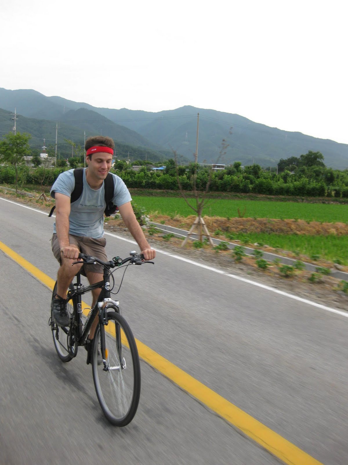
Brian's friends have also been...Cycling in Korea!

Brian's friends have also been...Cycling in Korea!

Cycling in Korea, Warning: always wear a helmet! (I gave mine to my friend)

Cycling in Korea, Warning: always wear a helmet! (I gave mine to my friend)

Popular Posts

Related Posts Plugin for WordPress, Blogger...